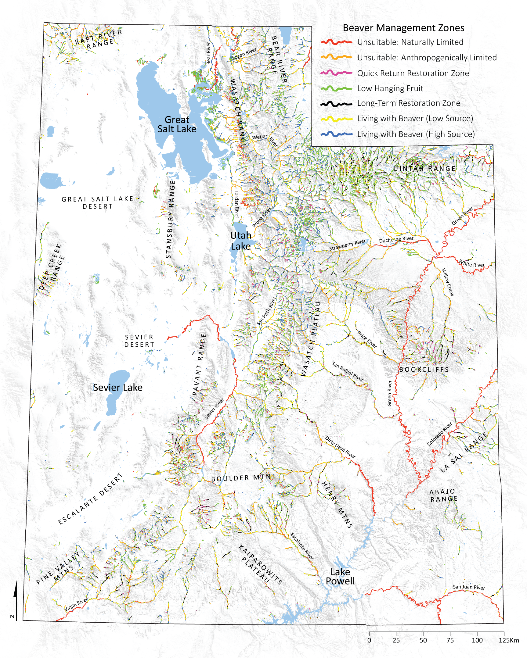
Utah BRAT 2014
This project focused on the development and application of the Beaver Restoration Assessment Tool (BRAT), a decision support and planning tool for beaver management, to analyze all perennial rivers and streams in Utah. The backbone to BRAT is a capacity model developed to assess the upper limits of riverscapes to support beaver dam-building activities. Both existing and historic capacity were estimated with readily available spatial datasets to evaluate five key lines of evidence: 1) a perennial water source, 2) availability of dam building materials, 3) ability to build a dam at baseflow, 4) likelihood of dams to withstand a typical flood, and 5) likelihood that stream gradient would limit or completely eliminate dam building by beaver. Fuzzy inference systems were used to combine these lines of evidence while accounting for uncertainty.
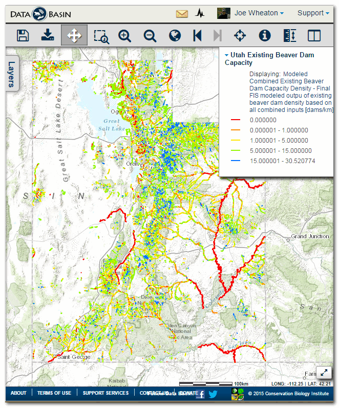
The capacity model estimated existing statewide capacity at 226,939 beaver dams (8.3 dams/km) and the historic capacity at 320,658 dams (11.7 dams/km), reflecting a 29% loss compared to historic capacity. Nearly all of this capacity loss can be explained in terms of vegetation loss and degradation associated with land use including: i) urbanization along the Wasatch Front and Cache Valley, ii) conversion of other valley bottoms to agricultural land uses, and iii) overgrazing in upland areas. Despite the losses, the relatively high proportion of publicly owned lands in the state and reasonable condition of many streams in the state mean Utah’s watersheds are still capable of supporting and sustaining a substantial amount of beaver dam- building activity. Dam capacity was found to be well distributed throughout each of the five Utah Division of Wildlife Resources (UDWR) regions in the state with slightly higher proportional capacity in the Northern and Central regions.
We verified the performance of the existing capacity model using 2,852 existing dams at four watersheds scattered throughout the state representing 12.5% of the 27,345 kilometers of perennial streams in the state analyzed. In all four watersheds, model performance was spatially coherent and logical, with electivity indices that effectively segregated out amongst the capacity categories. That is, beaver dams were not found where the model predicted no dams could be supported, beaver exhibited avoidance of reaches predicted as supporting rare or occasional densities, and beaver exhibited preference for areas predicted as having pervasive dam densities. Of the total 1,143 stream segments with validation dam counts only 15 exceeded the capacity estimates indicating that the model effectively segregates the factors controlling beaver dam occurrence and density 99% of the time. These watersheds had average dam densities ranging from 0.1 dams/km to 1.6 dams/km with an average of 0.83 dams/km and roughly 9% of modeled capacity. We found that validation watersheds in the northern portion of the state were currently at a higher percentage of capacity than watersheds in the southern portion. The Logan/Little Bear watershed (Northern Region) is currently 16% of capacity and Strawberry watershed (Northeastern Region) is 13%; whereas, the Fremont watershed (Southern and Southeastern Regions) and Price watershed (Central and Southeastern Regions) are currently both only 1% of existing capacity. If these validation watersheds are in fact representative of statewide trends then dam-building beaver populations across the state are only at a small fraction of the actual capacity and are much lower in the southern portion of the state than in the northern.
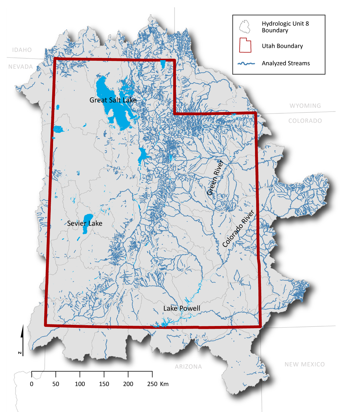
Figure 1. Map showing areas where BRAT was run as part of the UDWR Utah BRAT project.
| Sponsor | Geography | Year(s) | Status | |
|---|---|---|---|---|
| Utah Division of Wildlife Resources |  |
State of Utah | 2014-2015 | Complete |
BRAT data for that state of Utah can be downloaded from Utah AGRC, Databasin, or directly from ETAL. The ETAL dataset is organized into different coverages including statewide (i.e., Utah only), hydrological regions, and UDWR Management Regions.